What is a Cloudburst?
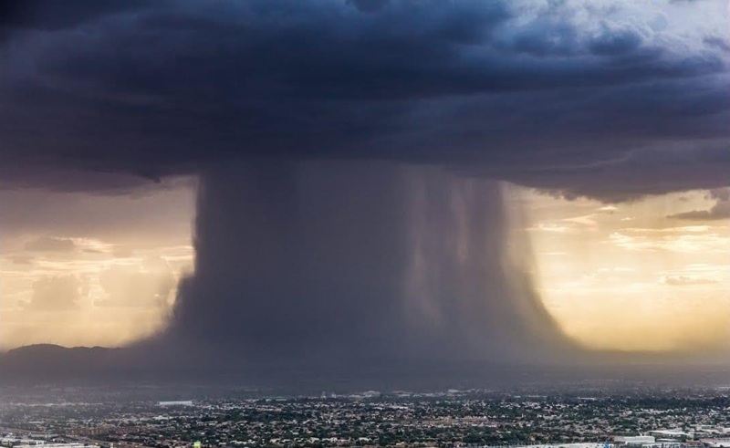
A cloudburst is an extreme weather event characterized by an intense and sudden downpour, usually over a very small area, in a short period, often less than an hour. These events typically produce rainfall of more than 100 mm (4 inches) per hour, leading to flash floods, landslides, and widespread destruction. Cloudbursts are most common in mountainous regions where orographic lifting of moist air masses rapidly cools and condenses to produce torrential rain.
Unlike regular rainfall, cloudbursts are highly localized and difficult to predict accurately with current meteorological tools. They usually occur without much warning and overwhelm natural and man-made drainage systems, triggering catastrophic flooding in minutes.
Recent Cloudburst Disasters in Asia
In 2025, several Asian nations have experienced devastating cloudbursts:
- India (Himachal Pradesh, Uttarakhand, and Ladakh): Northern Indian states witnessed multiple cloudburst events during the monsoon season, resulting in landslides, flooded villages, and damaged infrastructure. In Ladakh, a cloudburst in early August killed at least 12 people and left several missing as homes were swept away by sudden floods.
- Pakistan (Gilgit-Baltistan and Khyber Pakhtunkhwa): A series of cloudbursts triggered flash floods and landslides in the northern regions, killing dozens and displacing thousands. The mountainous terrain and limited drainage made the situation worse.
- Nepal and Bhutan have also reported cloudburst-related disasters in remote hilly regions, with road blockages, crop damage, and fatalities.
The common thread in all these incidents is the speed and unpredictable intensity of the rainfall, which often occurs during already saturated monsoon months.
Read Also: Understanding a cloudburst as about 100 people go missing in Uttarakhand flash floods
How Do Cloudbursts Happen?
Cloudbursts usually occur under the following conditions:
- Orographic Lift: Moist air is pushed upward by mountainous terrain, cooling rapidly at higher altitudes.
- Atmospheric Instability: Warm and moist air rises quickly, forming cumulonimbus clouds that grow rapidly and produce torrential rain.
- Wind Convergence: The meeting of winds from different directions leads to vertical uplift, enhancing the intensity of cloud formation.
- Blocked Air Currents: Sometimes, lack of wind prevents clouds from dispersing, causing them to release all their moisture in one area.
These conditions are amplified by climate change, which has increased the intensity and frequency of extreme weather events, including cloudbursts.
Preventive Measures and Action Steps
While cloudbursts cannot be prevented, preparedness and mitigation can significantly reduce their impact:
- Early Warning Systems: Investing in advanced radar and satellite-based weather forecasting systems to monitor high-risk zones.
- Infrastructure Planning: Constructing better drainage systems, landslide barriers, and flood-proof housing in vulnerable areas.
- Evacuation Protocols: Authorities must develop and regularly update disaster response plans for local communities.
- Afforestation and Watershed Management: Restoring vegetation and natural water-absorbing landscapes to reduce runoff.
- Community Awareness: Educating people in high-risk areas about the signs of an impending cloudburst and emergency procedures.
Cloudbursts are becoming an increasingly dangerous phenomenon in South Asia, exacerbated by climate variability and poor land use planning. As recent events in India, Pakistan, and neighboring countries show, the consequences can be devastating. Governments, scientists, and communities must work together to strengthen resilience, improve forecasting, and implement long-term environmental strategies to cope with these sudden disasters.