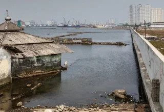



An intense magnitude 7.7 earthquake hit the coast of Flores Island in the Indonesian province of East Nusa Tenggara today, spreading its effects throughout eastern Indonesia and causing general panic. The shallow undersea quake hit at 5:58 a.m. local time, causing disaster management officials to raise a temporary tsunami warning for Indonesia and send out urgent warnings for coastal evacuation.
Heavy reports of structure collapse, hospital evacuation, power outages, and several casualties have been reported in the affected regencies. Teams of emergency personnel are on the ground evaluating the damage wrought by the 7.7-magnitude earthquake that hit Flores, as strong aftershocks are still felt in the area.
7.7 Magnitude Quake Flores: Epicenter, Depth, and Shaking Intensity
The earthquake has hit at very shallow depth of 10km as confirmed by data from U.S. Geological Survey (USGS) and Indonesia’s BMKG (Meteorology, Climatology, and Geophysics Agency).
Location Breakdown:
• Epicenter: 68 km North-Northwest of Ende (Flores Island)
• Depth: 10 km (Shallow thrust faulting)
• Coordinates: 8.31°S, 121.35°E
• Primary Affected Areas: East Nusa Tenggara, West Nusa Tenggara, South Sulawesi
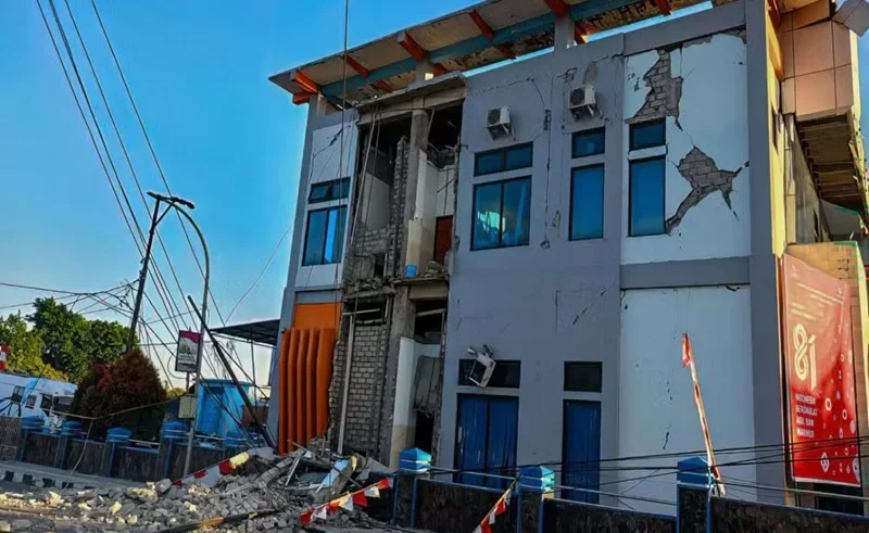
Millions felt the strong shaking on adjacent islands. Strong ground shaking led to structural collapse at Sikka, Nagekeo and Ende Regencies. In the port of Lorens Say in Maumere, big concrete buildings collapsed, and roofs collapsed at local churches and schools.
Indonesia Tsunami Warning Issued and Later Lifted by BMKG
BMKG activated 22 coastal areas into high alert status in 4 provinces immediately after the main shock, namely the province of East Nusa Tenggara, West Nusa Tenggara, South Sulawesi and Southeast Sulawesi. People were advised to evacuate low-lying areas around beaches and riverbanks right away.
Minor sea level changes (between 0.36 to 0.94 m) were recorded at coastal check points using tide gauge sensors. The sea level monitoring in the area had been ongoing for almost two hours with no significant anomaly surges, making it possible for officials to officially lift the Indonesia tsunami warning.
However, disaster mitigation agencies continue urging the public to stay cautious due to ongoing aftershocks in Indonesia.
Official Evacuation Advisory Protocol:
Coastal Zone Alert → Move >2 km Inland or 10m High Ground → Monitor BMKG Advisories
Casualties, Hospital Evacuations, and Emergency Response
Local disaster management agencies (BNPB and Basarnas) have confirmed deaths and several injuries. In Sikka and Ende, hospital staff had to evacuate patients to the outside due to severe structural damage. Medical and rescue teams set up temporary emergency triage stations in parking lots with makeshift tents, oxygen cylinders and mobile beds to ensure that patients’ care continues safely while they were in the midst of constant tremors.
There are communication problems and power outages in mountainous areas, which are hampering search and rescue operations. The government has deployed military and police troops to clear roads in the landslide areas along the Trans-Flores highway.
Stay updated on official disaster response efforts via the official Indonesian National Board for Disaster Management (BNPB) or verify seismic updates through the USGS Earthquake Hazards Program. You can also monitor real-time weather and tsunami alerts at the Indonesia BMKG Official Portal.
FAQs
What was the exact magnitude of the Indonesia earthquake today?
The seismic event was recorded at a magnitude of 7.7 by the USGS and BMKG at a shallow depth of 10 kilometers off the northern coast of Flores.
Is the Indonesia tsunami warning still active?
No, the official Indonesia tsunami warning issued by BMKG was withdrawn after coastal monitoring confirmed no destructive wave activity.
Why is Indonesia prone to severe quakes?
Indonesia lies directly along the Pacific “Ring of Fire,” where convergent tectonic plates (the Indo-Australian and Sunda plates) regularly cause seismic and volcanic activity.
Earthquake Updates From Around the World
How Is Kumamoto Recovering After Quake?
Check out the latest relief and recovery efforts in Kumamoto.
Can Colombia’s Rescuers Reach Survivors?
Find the latest updates on Colombia’s rescue operations.
What Happened During Mindoro’s Earthquake?
Uncover the latest tremors and PHIVOLCS updates.
How Will Japan’s Relief Package Help?
Browse the latest government support for Kumamoto.
Is Kumamoto Showing Signs Of Recovery?
See how the city is beginning to recover.