
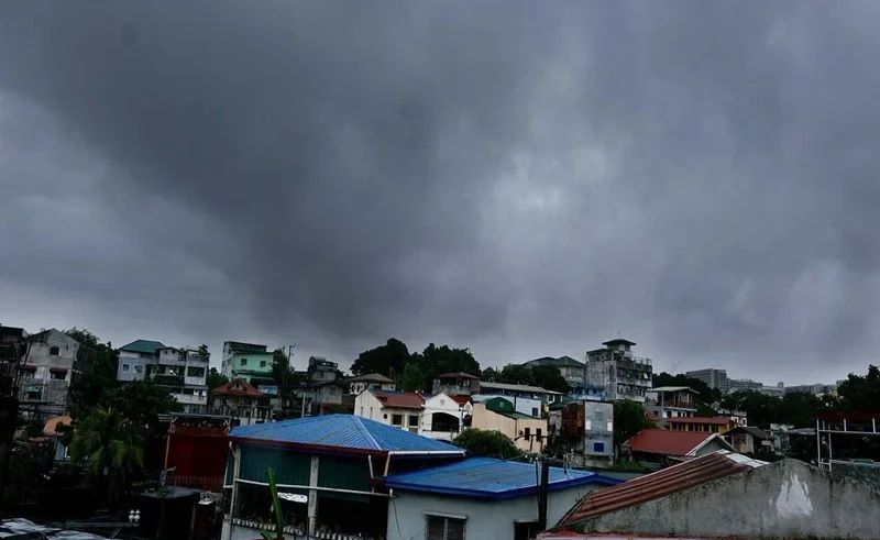
The state weather bureau, PAGASA, has kept the Tropical Cyclone Wind Signal No. 2 up over various provinces in Northern Luzon as Tropical Storm Maymay (Kujira) is sweeping across the sea. The monsoon rains are expected to be heavier, and people in the affected areas should be alert to strong winds and coastal flooding.
Below is the full PAGASA weather update on the storm’s landfall forecast, track and affected provinces.
Tropical Storm Maymay Current Location and Wind Strength
DOST-PAGASA latest bulletin revealed that the center of Tropical Storm Maymay passed off the coast of La Union. The system is moving slowly near the western coast and has maximum sustained winds of 65 km/h at the centre and gust of up to 80 km/h.
Current Typhoon Status Overview
- International Name: Kujira
- Local Name: Maymay
- Maximum Sustained Winds: 65 km/h near the center
- Peak Gustiness: Up to 80 km/h
- Movement: Slow-moving off Northern Luzon
Areas Under Signal No. 2 Areas and Wind Signal No. 1
PAGASA has issued Tropical Cyclone Wind Signal (TCWS) No. 2 in several strategic areas as the winds are expected to reach gale force and are considered moderate endangering to life and property.
Complete List of Signal No. 2 Areas
As reported by the Philippine News Agency, the following localities are currently under Signal No. 2 areas:
- Ilocos Sur: Central and southern portions
- La Union: Northern and central portions (including San Fernando City, Bacnotan, and Bauang)
- Pangasinan: Northwestern portion (Anda, Bolinao, Bani)
- Abra: Southwestern portion
- Mountain Province: Western portion
- Benguet: Northwestern portion
Areas Under Signal No. 1
Strong winds of 39 to 61 km/h are expected in areas under Signal No. 1:
- Ilocos Norte, remaining areas of Ilocos Sur, La Union, Pangasinan, Abra, Benguet, and Mountain Province
- Apayao, Kalinga, Ifugao, Cagayan, Isabela, Quirino, and Nueva Vizcaya
- Northern portions of Zambales, Tarlac, Nueva Ecija, and Aurora
Stay ahead of the latest weather alerts.
Will Classes Stay Suspended Longer?
Check out the latest PAGASA rain outlook.
How Hot Will It Get?
Find the areas facing dangerous heat levels.
Is Sinlaku Heading Philippines Soon?
See the newest PAGASA storm update.
Will Metro Manila Stay Dry?
Browse today’s thunderstorm forecast details.
What’s Today’s PAGASA Weather Alert?
Get to know the latest typhoon warnings.
Landfall Forecast and Heavy Rainfall Warning
Weather advisories published on Inquirer.net highlight a high risk of localized severe flooding and rain-induced landslides.
Estimated Track and Landfall Window
The Kujira latest track shows that the storm will also take an eastward track, heading closer to coastal areas of Ilocos Sur and La Union. A direct landfall forecast involves landfall along the west coast of Northern Luzon before the storm passes into the mountainous inland terrain.
Enhanced Southwest Monsoon Hazards
The enhanced Southwest Monsoon (Habagat) also generates a continuous heavy rainfall warning in Central Luzon, Southern Luzon and the Visayas in addition to the storm center.
- Torrential Rains: Heavy to strong rainfall (100 – 200 mm) is forecast in La Union, Benguet and Ilocos Sur.
- Coastal Risk: High waves and rough seas make travel by sea dangerous for smaller sea craft.
- Soil Saturation: Upland Cordillera soils are a major risk for landslides.
FAQs
What is the international name for Tropical Storm Maymay?
The international designation for Tropical Storm Maymay is Kujira, assigned by the Regional Specialized Meteorological Center.
Which regions are most affected by the latest Kujira track?
The Kujira latest track primarily impacts Northern Luzon, specifically Ilocos Region, Cordillera Administrative Region, and parts of Cagayan Valley.
Where is the primary landfall forecast expected?
The official landfall forecast points to the coastal areas of Ilocos Sur or La Union.
What precautions should residents in Signal No. 2 areas take?
Residents in Signal No. 2 areas should secure light structures, stock emergency supplies, and follow local evacuation orders due to threat of gale-force winds and torrential rains.